As of July 18, the Buhl Fire, caused by lightning and active since June 29, has burned approximately 42,615 hectares — including 8,470 hectares within Prince Albert National Park and 34,146 hectares on provincial Crown land.
🔥 The fire remains out of control, but no significant growth toward communities was reported on July 17.
🛰️ Updated maps will be posted as the perimeter changes.
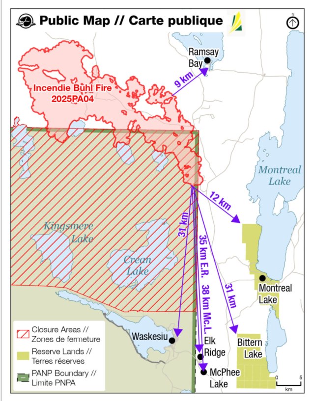
Fire Location (as of July 18):
-
9 km from Ramsay Bay
-
12 km from Montreal Lake Cree Nation
-
31 km from Waskesiu
-
32 km from Bittern Lake
-
35 km from Elk Ridge
-
38 km from McPhee Lake
Evacuation Trigger Points:
-
Trigger 1 – MacLennon River Area: Prepare to leave on short notice
-
Trigger 2 – Crean River Area: Evacuation order if reached (no re-entry)
Stay Informed & Prepared:
-
📞 Weyakwin Protection Base: (306) 663-5620
-
🔥 Fire ban remains in effect for Lakeland No. 521
📄 View Full Bulletin – July 18 (PDF)
🗺️ View Current Buhl Fire Map (JPG)
Stay alert, stay safe, and please check back for updates.